Oakland International Airport (OAK)
Orientation and Maps
(Oakland, California (CA), USA)
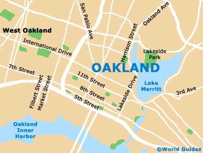
A coastal Californian city of sunshine and history, Oakland is home to one of the largest ports in America and is best explored on foot. Self-guided walking tours are especially popular in the city of Oakland and maps are available at the Oakland Convention and Visitors Bureau, along 14th Street.
Close to San Leandro, Oakland International Airport (OAK) is often used by those flying into San Francisco and Berkeley. The airport is situated to the southeast of the city center and close to the I-880 interstate.
Oakland International Airport (OAK) Maps: Important City Districts
Oakland's Greyhound bus station can be found along San Pablo Avenue and features a number of long-distance routes. Local city buses between Oakland and San Francisco run at regular intervals and are operated by AC Transit. The city's Amtrak train station is situated at the Jack London Square and provides a popular way to reach the city, although the Alameda-Oakland ferries are without a doubt a more scenic way to arrive.
Prominent areas of Oakland include the Victorian Row, which you will find plenty of historic mid-19th century architecture. Those looking for a more oriental flavor should be sure to visit the Chinatown district, where Asian restaurants abound. Further eateries can be found around the waterfront, being especially concentrated in Jack London Square, on the southern side of Broadway.
USA Map
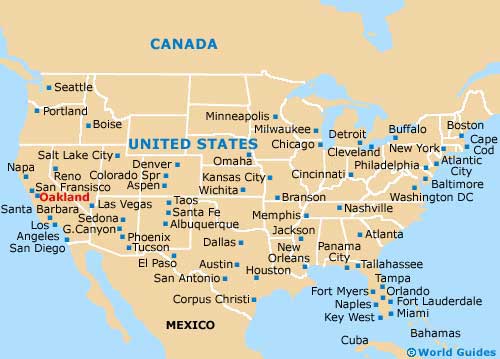
California Map

Oakland Map