Oakland International Airport (OAK)
Driving Directions / Travel by Car
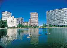
(Oakland, California - CA, USA)
Positioned just off the I-880 interstate (Nimitz Freeway), Oakland International Airport (OAK) is easily accessible from downtown Oakland and a variety of San Francisco Bay destinations. The area's interstates and highways are well signposted and easy to negotiate.
Running alongside the Oakland Airport complex, the Doolittle Drive passes the Chuck Corica Golf Complex, the Airport Channel, the Martin Luther King Junior Regional Shoreline and the Metropolitan Golf Links. Standing on the shoreline, alongside the San Francisco Bay, other roads close to the airport include the Harbor Bay Parkway, Island Drive, Mecartney Road, Maitland Drive and Robert Davey Junior Drive.
Also near to Oakland Airport, San Leandro lies directly east, while Hayward is located to the southeast and Alameda to the north.
Directions to Oakland International Airport (OAK) from the north
- Head south along the I-880 interstate
- Follow the exit signs for the airport on 98th Avenue
Directions to Oakland International Airport (OAK) from the south
- Head north along the I-880 interstate
- Exit the I-880 and join 98th Avenue for the airport
Directions to Oakland International Airport (OAK) from the east
- Head west along the I-238 interstate until reaching the I-880
- Join the I-880 interstate and head north
- Exit onto 98th Avenue and follow signs for the airport
Directions to Oakland International Airport (OAK) from the west
- From Alameda, take Highway 61 south until reaching 98th Avenue
- Follow the exit signs on 98th Avenue for the airport
Roads to the Oakland International Airport terminal and car parks can become congested during peak times of the day.
Oakland International Airport (OAK): Virtual Google Maps
